
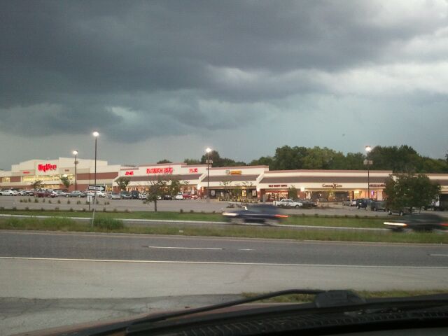
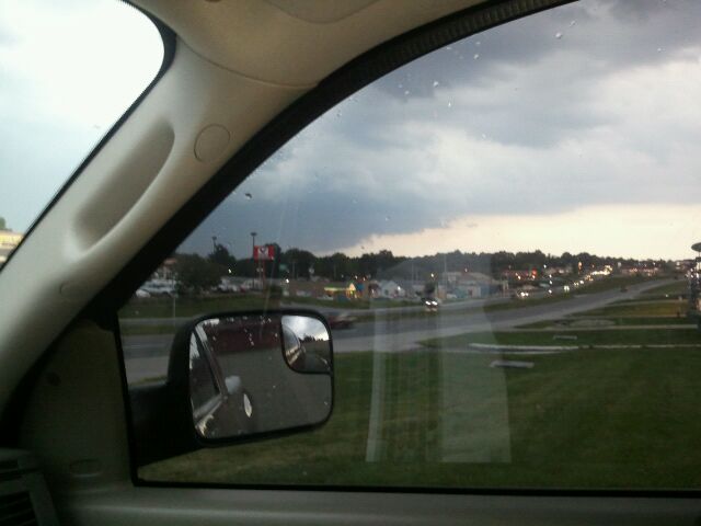
On our way back home from our daytrip in Chillicothe, Missouri, we got caught up in the heavy rain that may or may not be the season changer for our area. There was nothing really severe, except the heavy rain. I livestreamed our experience.
Watch live video from stevosvoboda on Justin.tv
My Blog List
Sunday, September 26, 2010
Wednesday, September 22, 2010
Rain Tonight -- Still Springlike Weather for Fall
I streamed and recorded this on my new phone while driving home from work.
Watch live video from stevosvoboda on Justin.tv
Watch live video from stevosvoboda on Justin.tv
Sunday, September 19, 2010
Storm Chase, Saturday Afternoon and Evening, 9-18-10
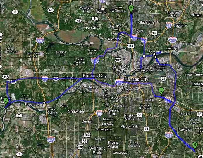
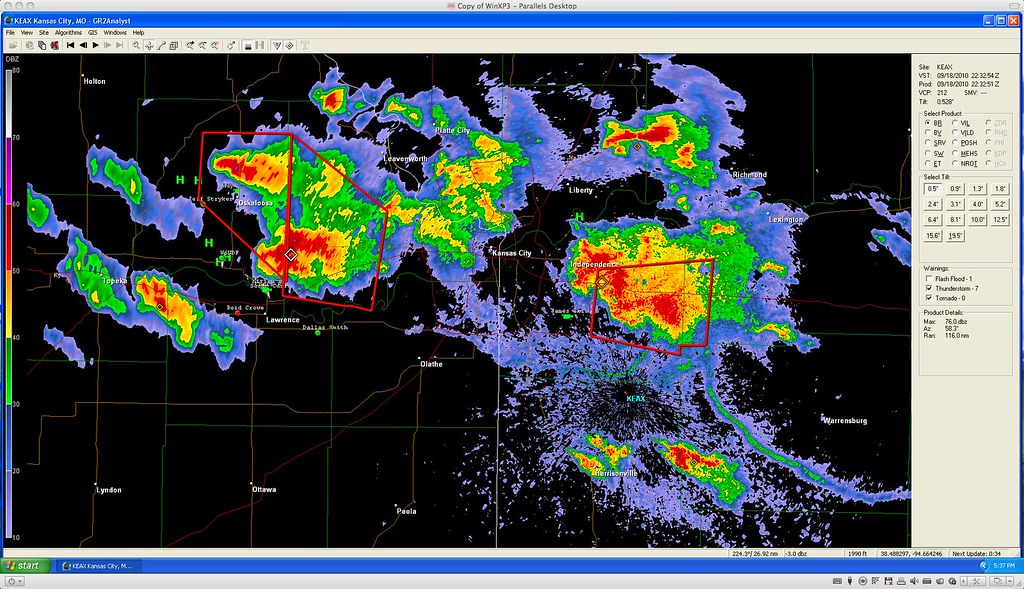
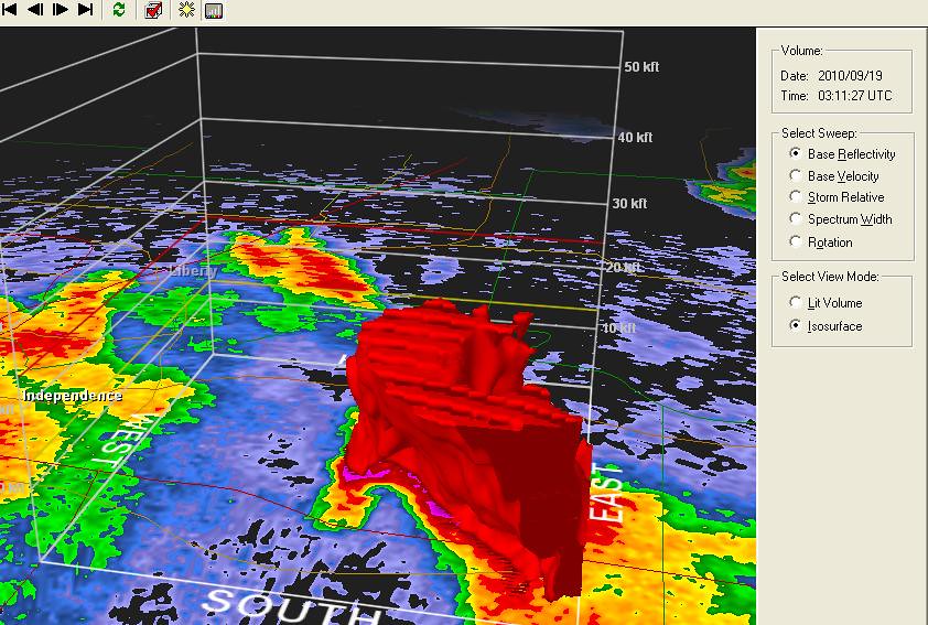
The warm conditions in combination with outflow boundaries and a nearby cold front made for perfect conditions for severe weather. The storms that fired tried very hard to produce, but it was just not enough. The cell forming over Independence showed promise, even though the Jefferson County Kansas storm had more potential. It seemed we would have a better chance catching something out of the Independence storm, if it produced, but it turned into a disorganized blob by the time we got south of it in Raytown.
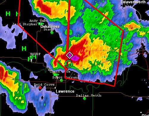
We then decided to head west on 70 towards Lawrence. Besti got hailed on by quarter sized hail right before the turnpike interchange. We decided to turn around and re-intercept the storm which had been the same cell that had tornado warnings attached to it over Oskaloosa Kansas earlier in the afternoon, but by this time it petered out. We stopped in Bonner Springs for a bathroom break and ice cream at the Dairy Queen, then we went home.
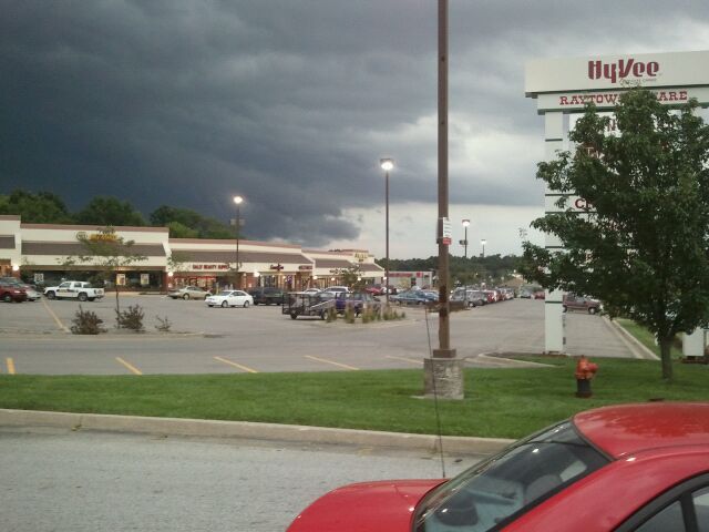
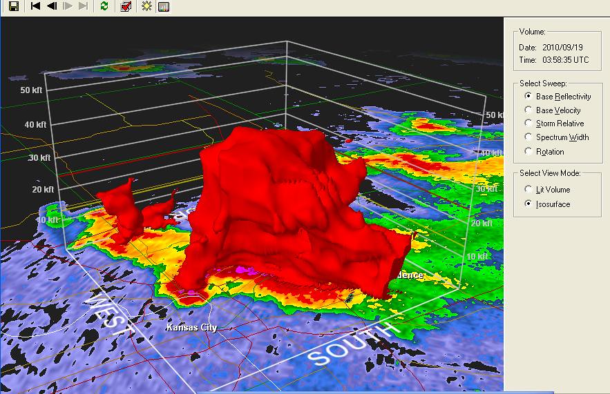
Severe cell over Independence, viewed from 350 highway in Raytown.
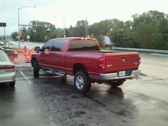
BETSI in Bonner Springs, Kansas
Storms that fired in Nebraska the night before, causing the outflow boundaries that interacted with warm moist air over NE Kansas and Western Missouri, creating the severe weather Saturday afternoon.

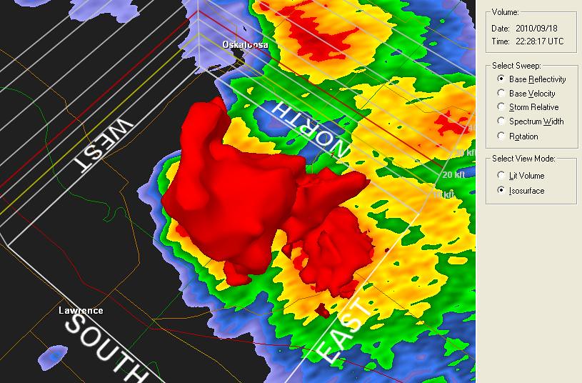
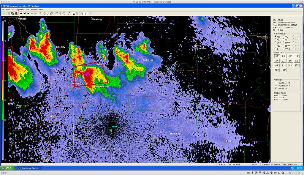
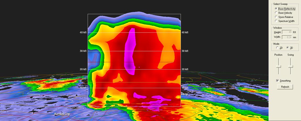
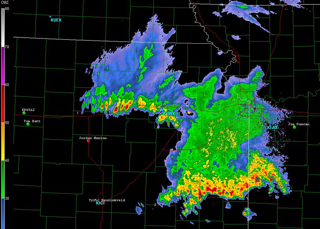
Storms started firing over Northeast and Central Kansas. They were descrete, then they started rotating, then they made the right turn heading south, though they were slow moving. The storm farthest to the west then showed good signs of rotation on radar, and was tornado warned soon after.
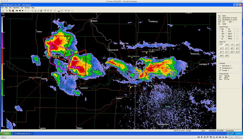
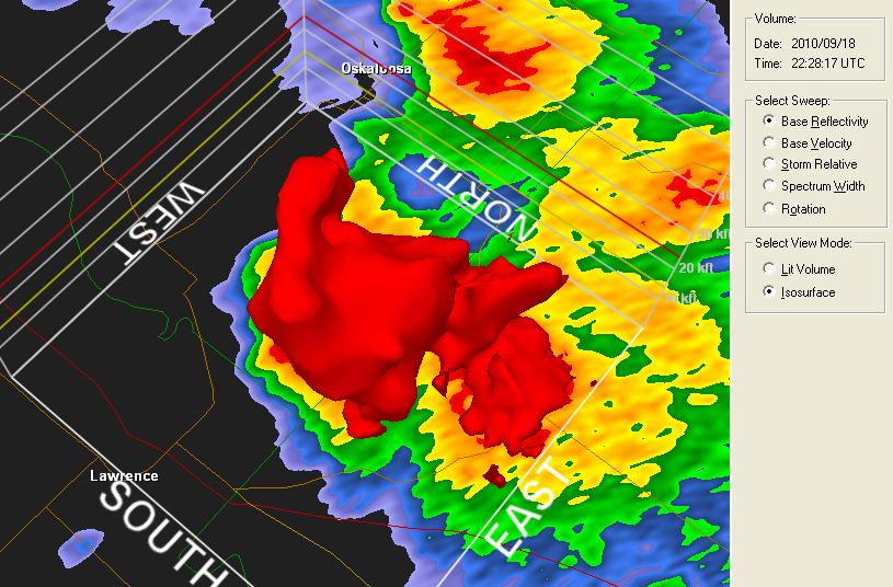
We chose to chase the storm over eastern Jackson county/ Independence.
We then went west towards Lawrence to catch the cell with a history of rotation/hail core.


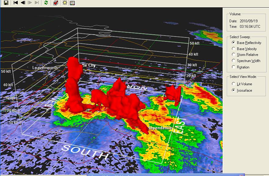
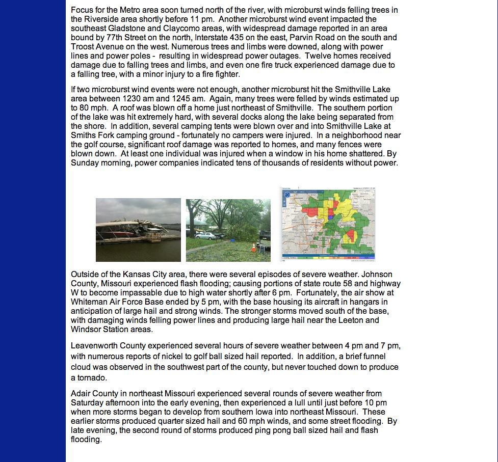
The storms kept firing late into the evening, intensifying, dying, then reforming and going severe. The worst of the severe weather hit the northland of the metro area late in the evening. One cell showed signs of rotation over the west bottoms of Kansas City, then merged with a cell over Leavenworth and moved north about 23:30.
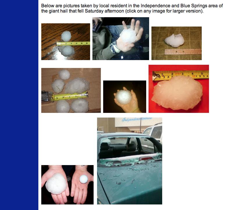
About the time the rotation couplet moved over our house at about 23:45, there was a brief severe burst of wind, probably lasting about 30 seconds. I had to go out and check to see if I could see anything, but with obscured vision due to trees and nighttime, I saw nothing. It was about this time that a lot of damage was occuring due to hail and high winds to the eastern part of Gladstone.
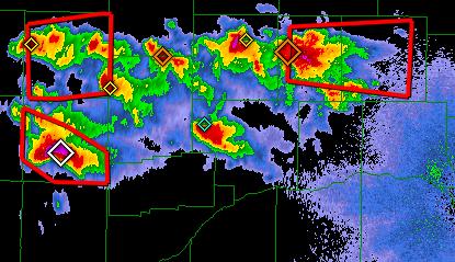
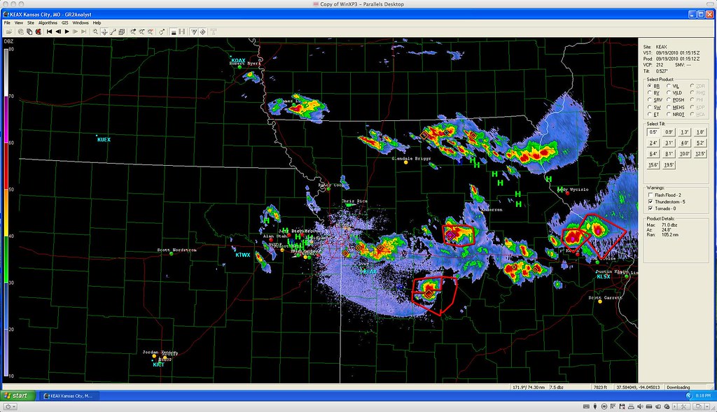
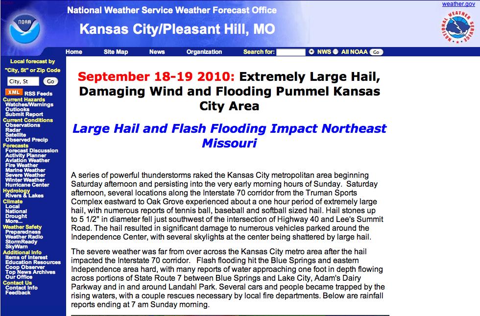
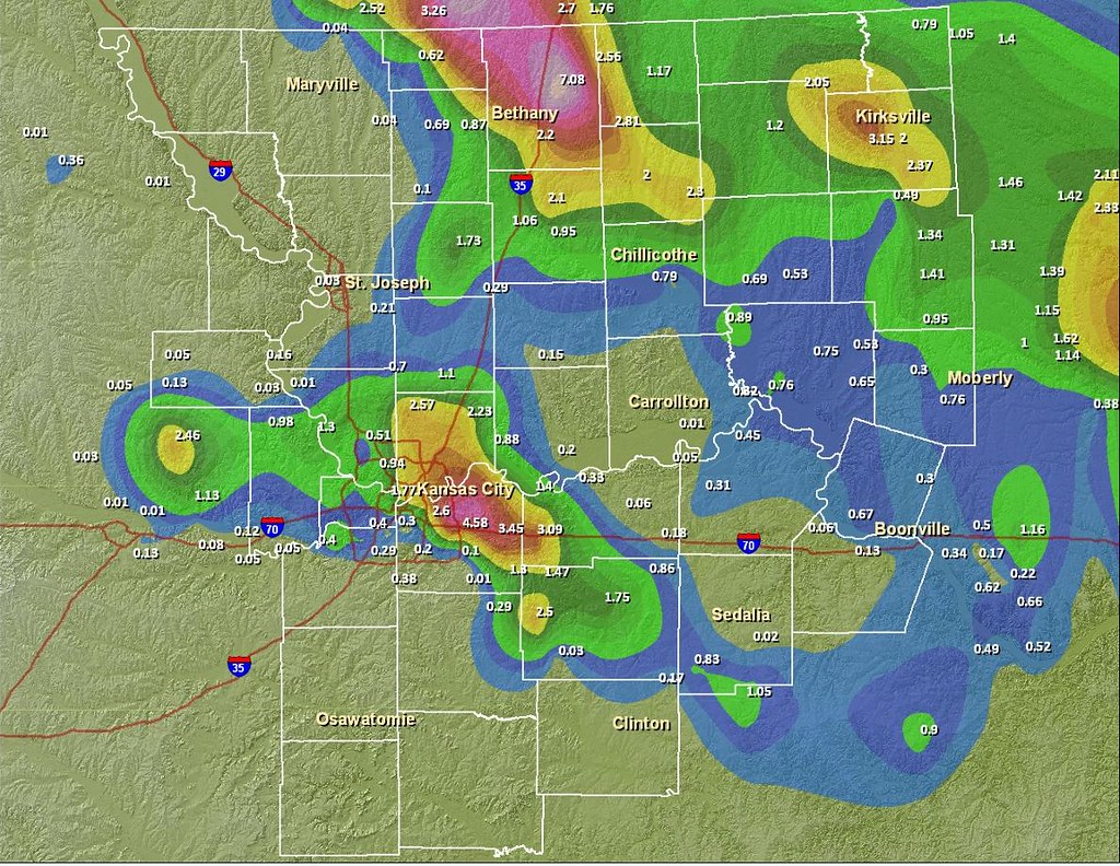
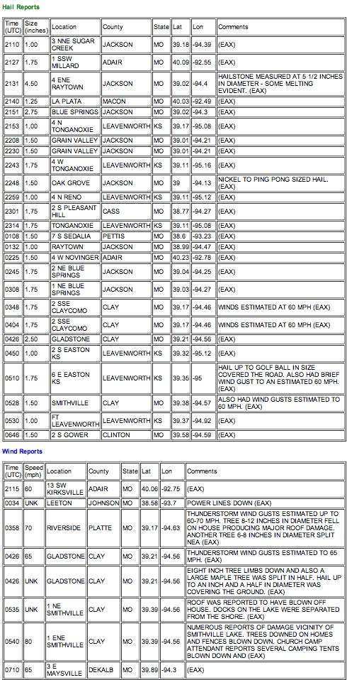
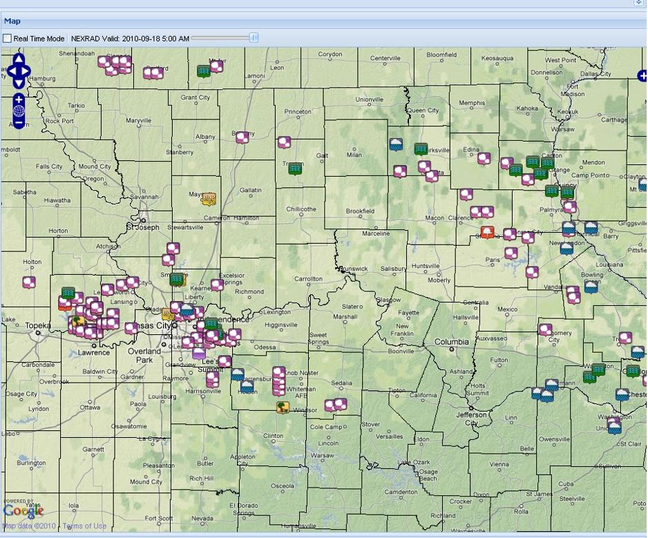
Storm Reports from the National Weather Service in Pleasant Hill, Missouri
Full credit and attribution for the following screen grabs belong to the Weather Service office in Pleasant Hill
Watch live video from stevosvoboda on Justin.tv
Saturday, September 18, 2010


Wednesday, September 15, 2010
Severe Possibility for Wed 15 September 2010
The severe threat may or may not be marginalized by the rain and cloud cover in the morning. Some strong storms have been moving across Kansas in the early morning hours gradually weakening as they did so.
We shall see what the timing and instability shall bring later in the afternoon -- most probably some straight line winds and heavy rain.
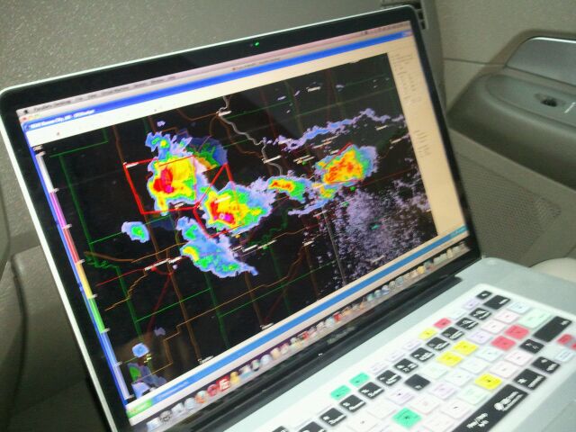
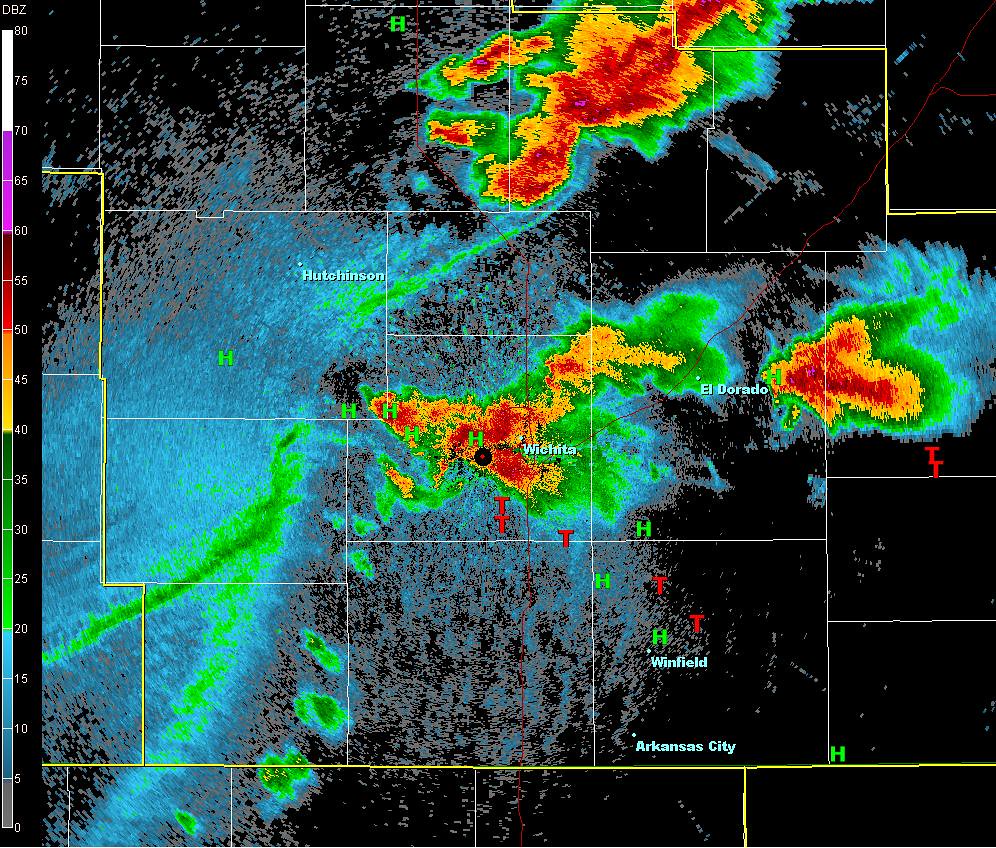
00:42 -- I had to work, but when I could get a chance, I got screen shots of what was happening around Wichita tonight. There were incredible reports of 6 to 7 inch hail in Wichita, as well as many posts on Youtube of baseball and softball sized hail. In Kansas City, there were just thunderstorms after the air had been stabilized from all the rain we had this morning.
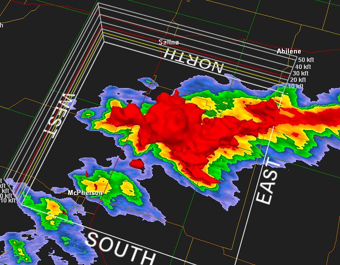
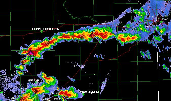


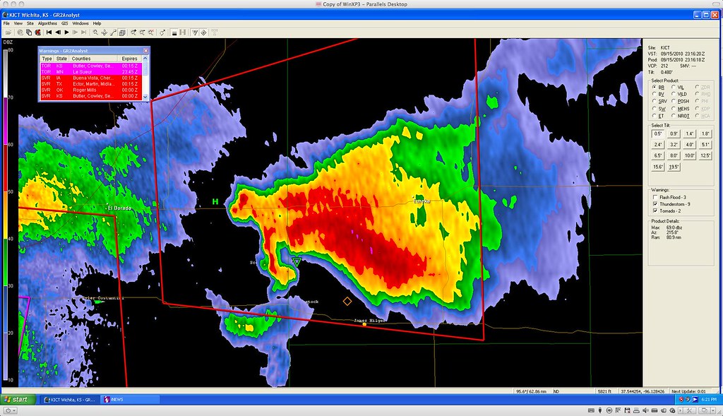


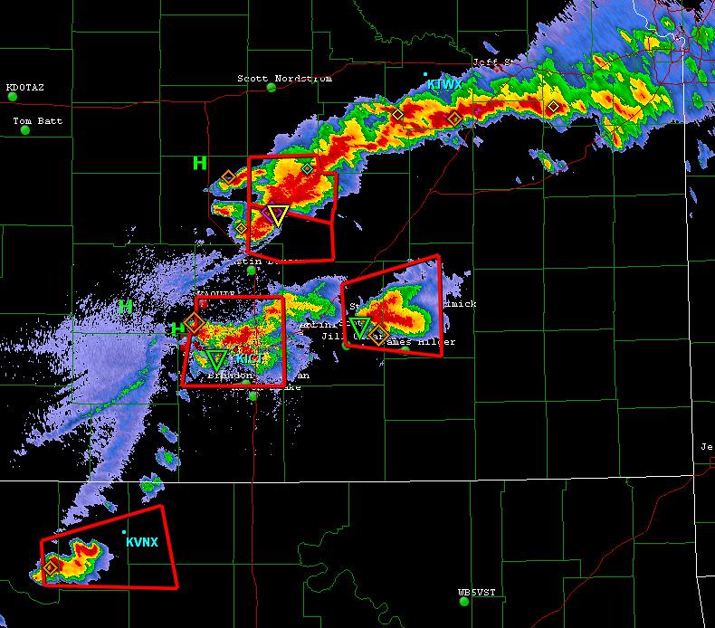
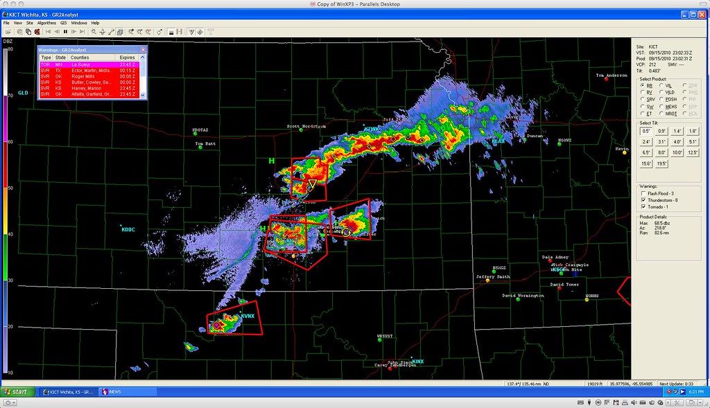
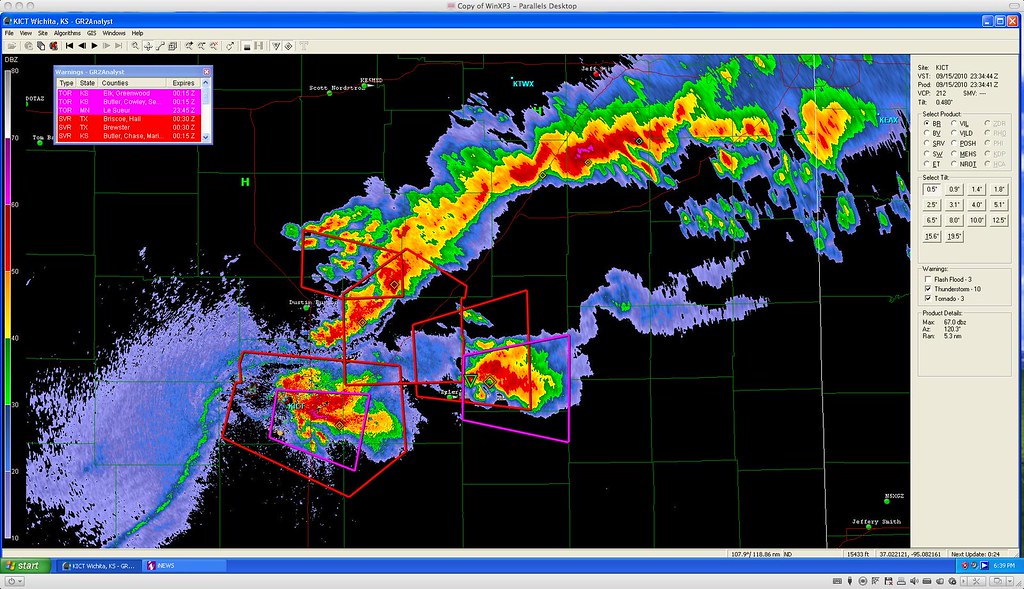
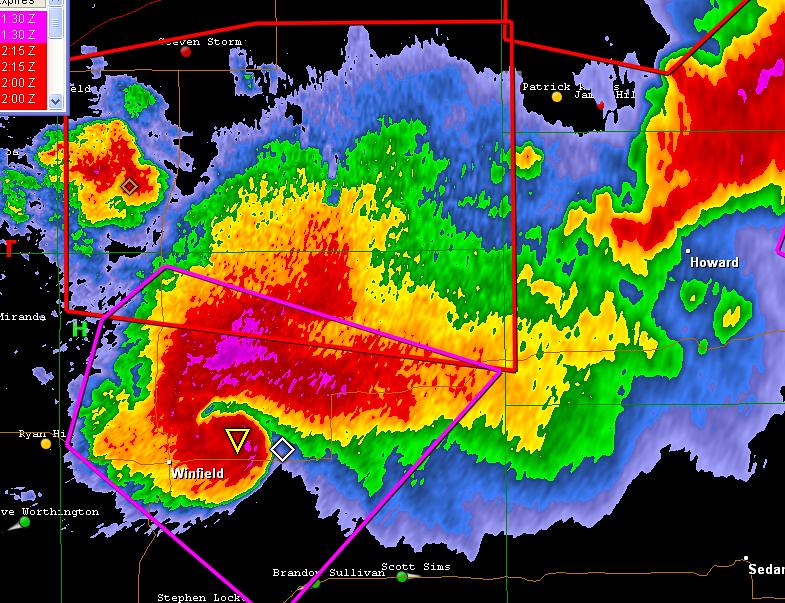
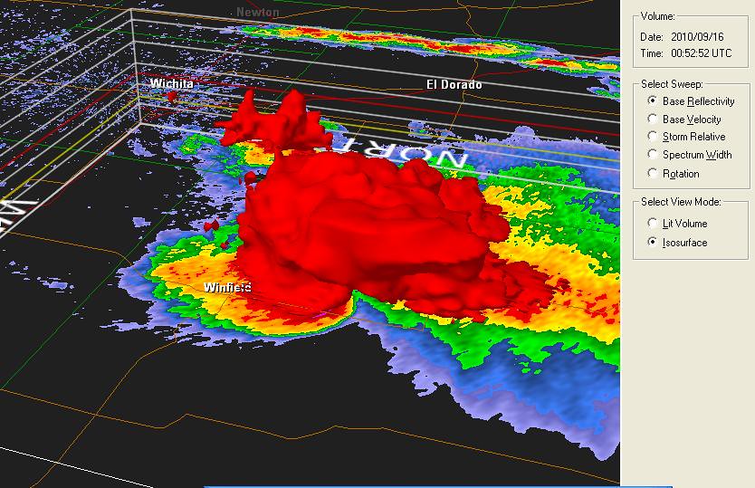
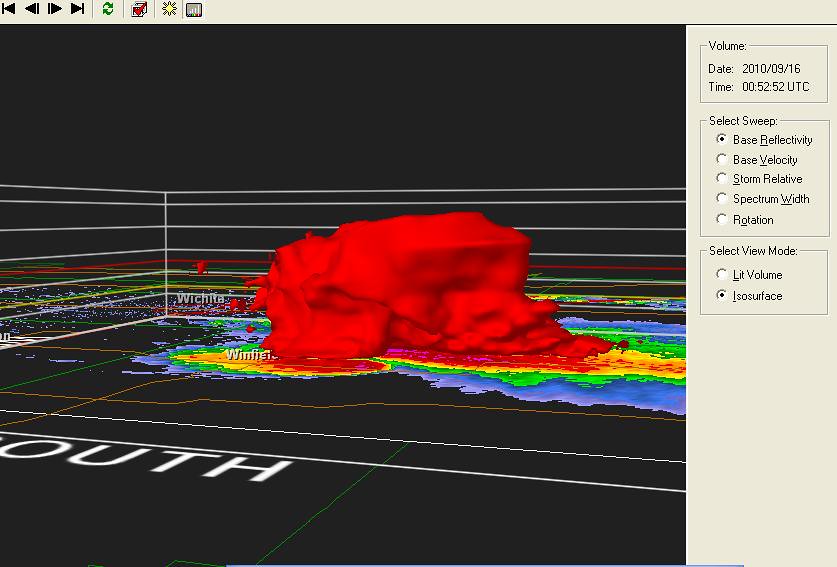
The storms quickly went sever and started rotating vigorously. After hitting Wichita with hail, and tornadoes to the south of Wichita, one cell took aim on Winfield, Kansas, which is worrysome with thousands of people there attending the Walnut Valley Music Festival. I got some incredible screen shots of the hook echo with what looks like a debris cloud. I'm awaiting final reports for the National Weather Service, but there are preliminary reports of damage. A co-worker of my wifes was at the concert. She said that the sirens went off, everyone went under the grand stands and there were a lot of awnings and tents and tree branches blown over everywhere, but concert goers were soon back to enjoying the show.
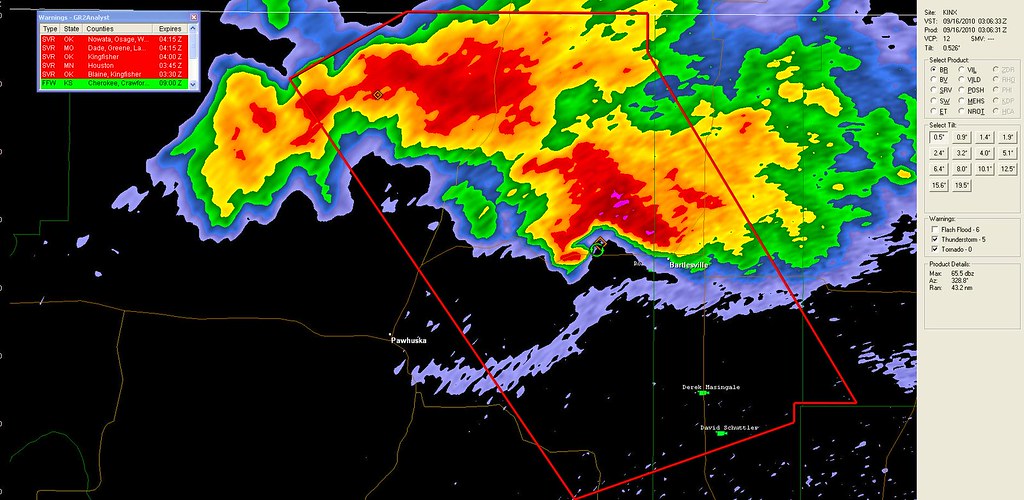
The storms continued to track southeast into Oklahoma, and kept trying to cycle. The last real effort was over Bartlesville Oklahoma.
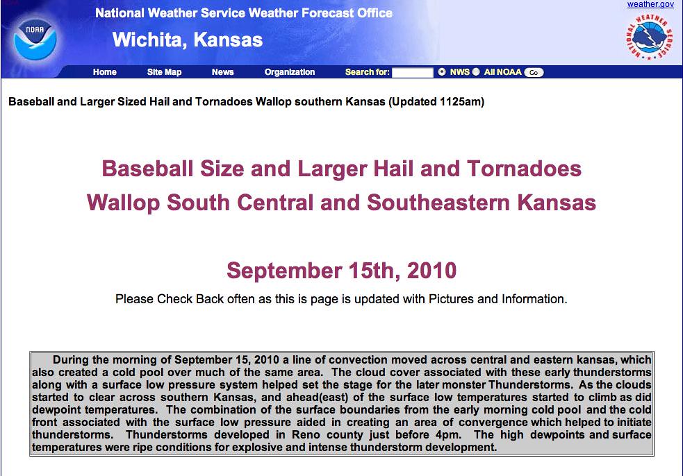
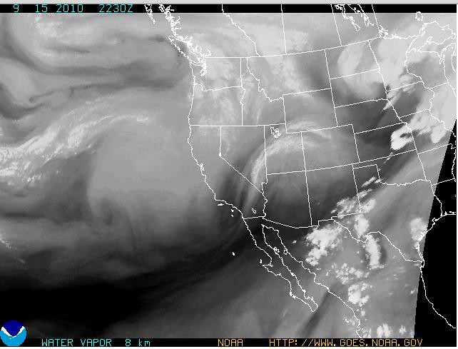
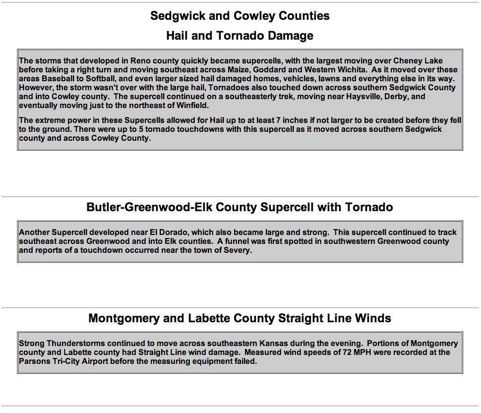
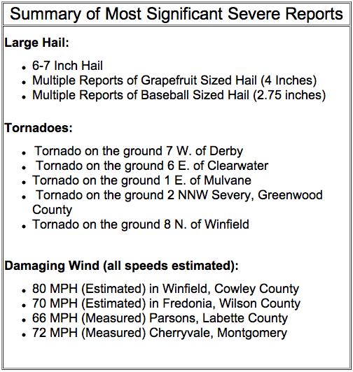
Summary from the NWS office in Wichita
Proper credit and attribution has to be given to the National Weather Service office in Wichita Kansas, from where I retrieved these screen grabs...
http://www.crh.noaa.gov/ict/
Watch live video from stevosvoboda on Justin.tv
00:42 -- I had to work, but when I could get a chance, I got screen shots of what was happening around Wichita tonight. There were incredible reports of 6 to 7 inch hail in Wichita, as well as many posts on Youtube of baseball and softball sized hail. In Kansas City, there were just thunderstorms after the air had been stabilized from all the rain we had this morning.
The storms quickly went sever and started rotating vigorously. After hitting Wichita with hail, and tornadoes to the south of Wichita, one cell took aim on Winfield, Kansas, which is worrysome with thousands of people there attending the Walnut Valley Music Festival. I got some incredible screen shots of the hook echo with what looks like a debris cloud. I'm awaiting final reports for the National Weather Service, but there are preliminary reports of damage. A co-worker of my wifes was at the concert. She said that the sirens went off, everyone went under the grand stands and there were a lot of awnings and tents and tree branches blown over everywhere, but concert goers were soon back to enjoying the show.
The storms continued to track southeast into Oklahoma, and kept trying to cycle. The last real effort was over Bartlesville Oklahoma.
Summary from the NWS office in Wichita
Proper credit and attribution has to be given to the National Weather Service office in Wichita Kansas, from where I retrieved these screen grabs...
http://www.crh.noaa.gov/ict/
Watch live video from stevosvoboda on Justin.tv
Subscribe to:
Posts (Atom)